 |
Using a point cloud and your project, we can check for the presence of interference and thus reduce the cost of carrying out the work.
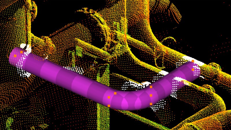
Integrating a new structure into a facility doesn't necessarily require modeling the existing one; the high-density surveys we carry out in the field generate point clouds in the project's coordinate system. By superimposing this project on the point cloud, we can use computer tools to identify any possible interferences.
This method saves a great deal of time, as the modeling stage disappears completely. Thanks to its high density, the point cloud is sufficient to perfectly describe the TQC.
Interferences between the existing and the project are directly visualized in 3D (in the Navisworks environment, for example), so nothing is left to chance. You'll avoid any rework during the construction phase!
|
Contact
Follow us
|
|
ZA Champ du roy. 219 chem. des goules 38670 Chasse-sur-rhône |