The city of Geneva operates a 3D GIS using ESRI software. This official 3D platform provides the basis for land planning throughout the Canton: planners, architects, infrastructure managers and political decision-makers can all rely on the realistic visualisation provided by this GIS and can benefit from all the geographical information included within it.
The geometrical basis of the GIS was provided mainly from aerial lidar surveys which enabled the capture of buildings in 3D, the natural landscape and the road network.
 |
Chantier réalisé dans le cadre du consortium OA3D (Haller SA – Spatial SA – TPLM-3D) |
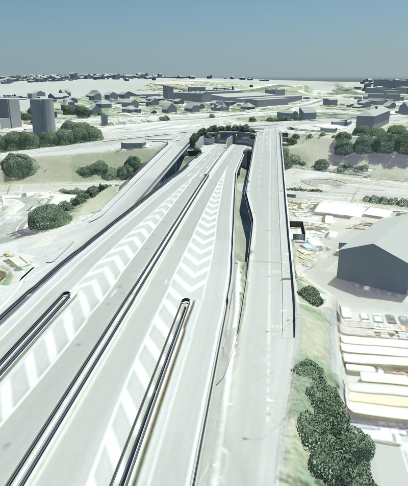
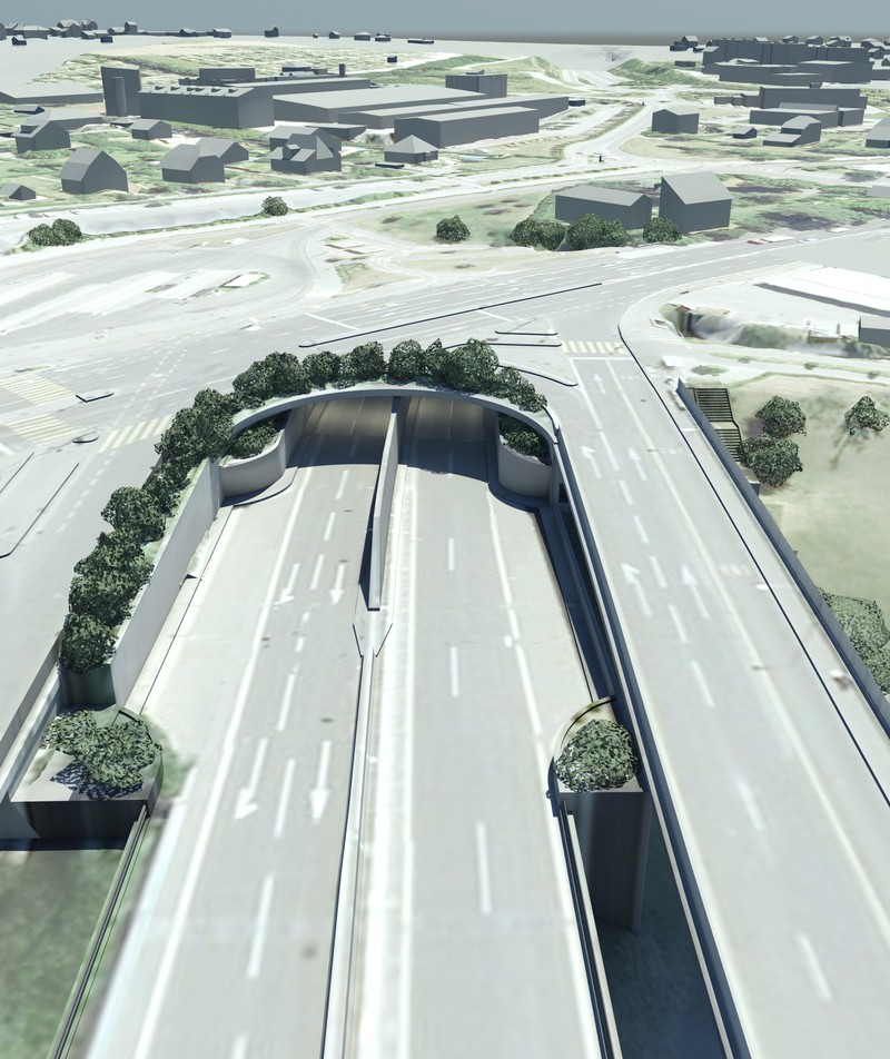
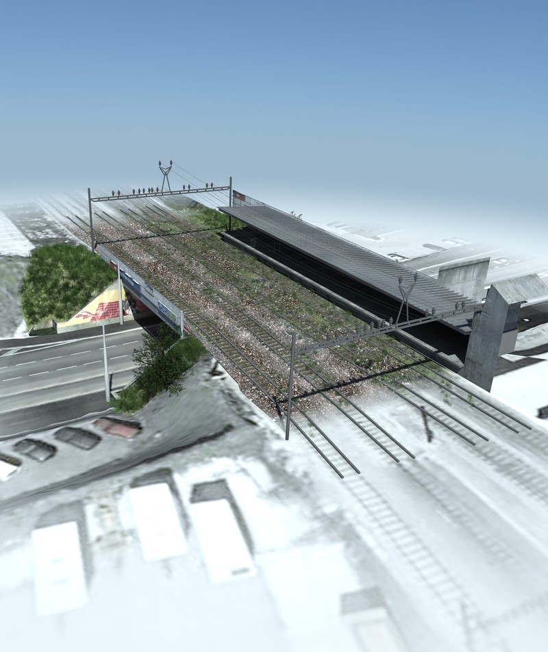
The full complexity of structures such as tunnels, walkways, viaducts and bridges cannot be modelled by lidar surveys. For this reason a consortium was formed to bring together the expertise of Ch. Haller, TPLM-3D and Spatial SA ; for 11 years our three companies have worked together on projects requiring our range of skills including metrology, major topographic surveys, GPS and GIS. Our varied experience has been combined in order to develop methods which meet the specifications of the Canton covering the surveys on the ground, quality control, 3D textured modelling and the final interface with the GIS.
The guiding principle of this ambitious project was the traceability of every stage of computation, from the field work through to the integration of the data into the GIS : checks on the vehicle trajectory by GPS observations at control points, analysis of the point clouds and checks on the conformance between the 3D models and the point clouds. For each structure, every stage of the work resulted in a recognisable individual record.
For this task, the required 3D models had to be accurate (15 cm at any point) but “lightweight” and easily manipulated. We therefore opted for a modelling method developed in the course of our own programme of R&D over the past ten years. The objectives were to model complex shapes using laser scanner data, to guarantee various appropriate levels of accuracy, to texture the models and to be able to deliver them in formats suited to the needs of our clients.
The first stage of this programme is to extract a wire-frame model of the structure, followed by the generation of surfaces (meshes or geometrical surface figures as appropriate). One thus obtains a geometrical framework which perfectly describes the object. The final model of the structure is generated at the next stage of the process, in which the 3D topology of the structure is also checked.
Texturing remains a tricky stage of the process. It implies a combination of generic textures with realistic textures generated from digital photography taken during the survey, which must be overlaid on the geometry with great precision. This texturing process using digital photography is controlled by the IMGSurveyor software developed by TPLM-3D. It uses the photogrammetric data for each exposure and applies it automatically to the 3D model.
 |
 |
 |
Contact
Follow us
|
|
ZA Champ du roy. 219 chem. des goules 38670 Chasse-sur-rhône |